The Fort Hunt corridor lies between Fort Hunt Road and the Potomac River, south of Alexandria. Nearly all of it was once part of two colonial estates: George Washington's River Farm and George Mason's Hollin Hall. A streetcar, a coastal fort, and a memorial highway followed. Between 1924 and the 1970s, the land became eleven neighborhoods.
The chapters below follow that history in order. Scroll, and the map follows.
The corridor in four minutes. A narrated short film of the history below, from River Farm to the eleven neighborhoods and how their houses were built, decade by decade.
Photographs: Library of Congress (HAER, HABS), National Park Service, National Archives, Internet Archive. Public domain.
Dates mark the founding or first sale, not the last house built. Several of these neighborhoods kept filling in for a decade afterward, which is why one street can hold a 1957 rambler and a 1968 colonial.
Neighborhood (approximate) Electric railway, 1892–1932 Landmark
Two Colonial Estates
1608–1799
The Doeg people (also recorded as Dogue, Taux, or Tauxenet) lived along this part of the Potomac before English settlement. Captain John Smith sailed past in 1608. In 1653 or 1654 the Brent family received the first English land patent here, about 1,800 acres, and the area became known as Piscataway Neck.
River Farm
George Washington became sole owner of Mount Vernon in 1754 and expanded it from 2,126 acres to more than 8,000. He ran the plantation as five farms; River Farm, the northernmost, covered the eastern and southern parts of today's corridor. A 1799 inventory lists fifty-seven enslaved people working at River Farm.
Hollin Hall
To the west lay Hollin Hall, which George Mason gave to his third son, Thomson Mason, by deeds of gift in 1781 and 1786. Hollin Hall Village, Hollin Hills, and Mason Hill all take their names from it.
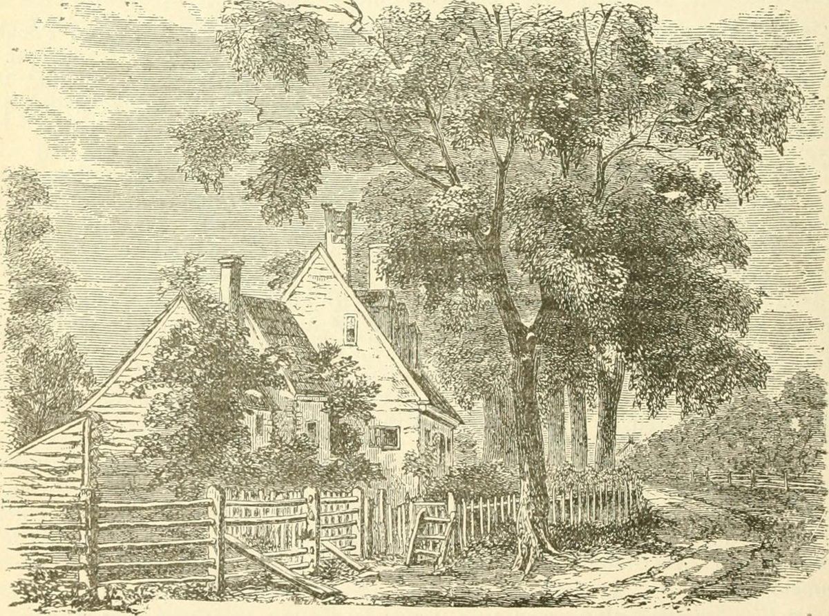
An old Fairfax homestead. An engraving from the guidebook published for riders of the electric railway.
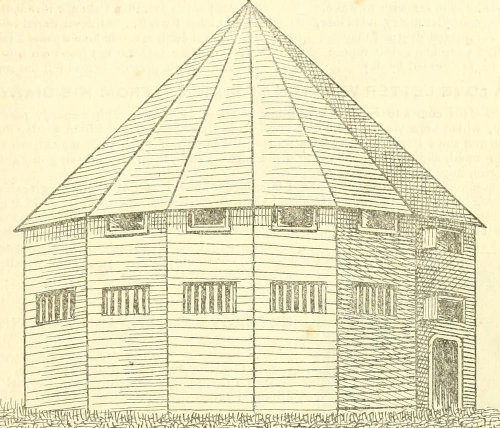
Some Old Historic Landmarks of Virginia and Maryland (1904). Public domain, via Wikimedia Commons and the Internet Archive.Washington's sixteen-sided barn. Built in the 1790s on Dogue Run, another of Mount Vernon's five farms, it let horses thresh wheat by walking in circles on the upper floor.
Some Old Historic Landmarks of Virginia and Maryland (1904). Public domain, via Wikimedia Commons and the Internet Archive.
The Electric Railway
1892–1932
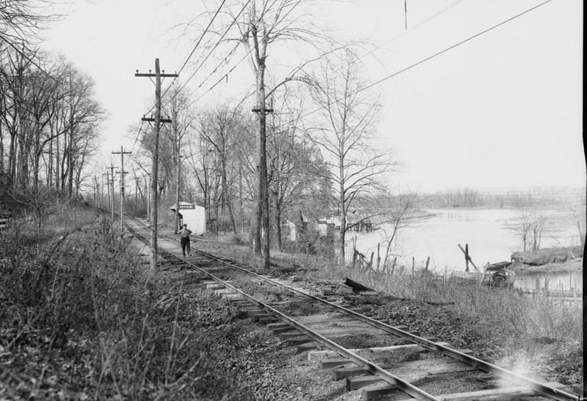
The Washington, Alexandria and Mount Vernon Electric Railway opened in 1892 as the first streetcar line in Northern Virginia. It followed the route of today's parkway to Collingwood Road, then turned inland along what is now Wittington Boulevard and crossed Little Hunting Creek. In 1906 it carried more than 1.7 million passengers on thirty trains a day.
The railway opened the corridor to people without horses or carriages. It closed in 1932, when the parkway replaced it.
The railway, 1930. The tracks shortly before crews removed them to grade the new parkway.
Historic American Engineering Record, HAER VA-69-207. Library of Congress, Prints & Photographs Division. Public domain.
Fort Hunt
1892–1946
Named forColonel and Brevet Major General Henry J. Hunt, U.S. Army
Built1897–1904, as part of the Endicott program of coastal defenses
Guns (1904)Three 8-inch rifles, three 3-inch and two 5-inch rapid-fire guns
TodayFort Hunt Park, part of the George Washington Memorial Parkway
A coastal fort
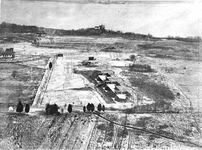
The War Department bought the land at Sheridan's Point, part of Washington's former River Farm, in 1892 to strengthen the river approach to the capital. Construction began in 1897. When war with Spain was declared in 1898, forty-eight men of the Fourth Coast Artillery were sent to garrison the post, but not until 1904 were all of its guns mounted. By 1918 the batteries had been dismantled and the guns moved to other forts. Six structures from this period survive, including concrete gun emplacements and a battery commander's station.
Fort Hunt in the 1920s. A clear field of fire surrounded the batteries; the battery commander's tower could direct fire at approaching ships and signal Fort Washington across the river.
National Park Service, Museum Resource Center. Public domain.
Between the wars
The War Department Finance School occupied the post from 1921 to 1923. An African American ROTC unit trained there in the early 1930s, housed in separate temporary quarters. Congress authorized the fort's transfer to the Office of Public Buildings and Public Parks in 1930, and from 1933 Civilian Conservation Corps Camp NP-6 landscaped the grounds.
In June 1939 King George VI and Queen Elizabeth became the first reigning British monarchs to visit the United States. On June 9 the king inspected Camp NP-6 with CCC director Robert Fechner. A pin oak in the park commemorates the visit.
P.O. Box 1142
The CCC left in 1942, and the Army returned under a special use permit on May 15 of that year. For the rest of the war, Fort Hunt was a secret intelligence center known only by its mailing address, P.O. Box 1142.
Army and Navy interrogators, working as MIS-Y, questioned 3,451 German prisoners there through July 1945, including U-boat commanders and crews; Wernher von Braun and his rocket scientists were questioned in the fall of 1945. A second program, MIS-X, trained American servicemen to evade capture and sent prisoners of war in Germany coded letters and escape aids hidden in parcels, between 80 and 120 packages a day by 1944. The site was declared surplus in November 1946. Its veterans kept the secret until the records were declassified in the 1990s.
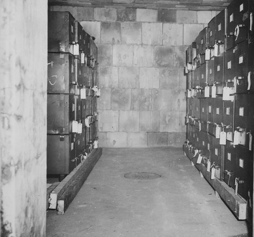
Battery Sater, 1943. With the guns long gone, the National Archives used the concrete batteries to store still photographs on nitrate film.
National Archives and Records Administration, via Wikimedia Commons. Public domain.
The Parkway
1929–1932
The Mount Vernon Memorial Highway, now the southern end of the George Washington Memorial Parkway, was built to carry visitors to Mount Vernon for the 1932 bicentennial of Washington's birth. Crews removed the railway tracks in 1930 and graded the road over much of the old route.
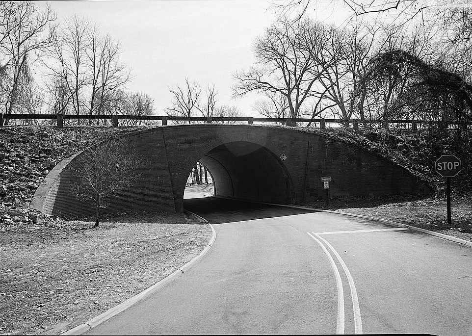
The Fort Hunt Overpass, begun in 1929, is a two-hinged reinforced concrete arch and was among the first parkway bridges maintained by the federal government. Unlike the parkway's other bridges, which are faced in stone, it is faced in brick.
The parkway made the corridor an easy drive from Washington. Nearly every neighborhood that followed was built for commuters.
The Fort Hunt Overpass. The Potomac is visible through the arch.
Jet T. Lowe for the Historic American Engineering Record, HAER VA-42-C-1. Library of Congress, Prints & Photographs Division. Public domain.
Belle Haven
1920s
DeveloperDavid Janney Howell, an Alexandria civil engineer
LandmarkFort Willard, a Civil War earthwork, still visible in the park at the neighborhood's center
Origins
The West family, prominent in colonial Fairfax, held this land; Hugh West sat in the House of Burgesses. In 1814 the family sold to Colonel Augustine J. Smith, who enlarged the plantation from about 155 acres to more than 1,800 by diking and draining Potomac marsh. The dike was not maintained after his death, and the low ground returned to marsh.
During the Civil War the Union Army built Fort Willard on the hill as part of the Defenses of Washington. Its earthworks survive in the neighborhood park.
Development
In the early 1920s Alexandria civil engineer David Janney Howell bought the land and formed two companies: one to build a golf club, the other to sell house lots around it. The first nine holes opened in September 1924. Building continued for decades, producing a mix of 1920s houses, postwar colonials, and later infill. Belle Haven is the only one of the eleven neighborhoods already visible in the county's 1937 aerial photographs.
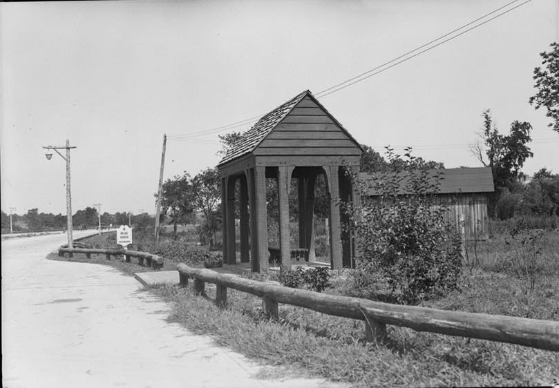
Belle Haven bus stop, 1932. A rustic shelter, guardrails, and lamp post at the Belle Haven stop on the new Mount Vernon Memorial Highway.
Historic American Engineering Record, HAER VA-69-214. Library of Congress, Prints & Photographs Division. Public domain.
For homeowners. Central air was added to the older houses later, often with several returns in unexpected places. On the low western ground, the sump pump deserves a spring test.
Wellington
1930s onward
OriginThe Wellington estate house on the old River Farm tract
Earlier ownersThe Snowden family, Quakers from New Jersey
StylesRamblers, colonials, and larger river-facing houses on generous lots
NearbyCollingwood Park and the Mount Vernon Trail
Origins
Wellington takes its name from one of three estate houses built on former River Farm land along today's parkway; the others were Andalucia and Collingwood. The houses were associated with the Snowden brothers, New Jersey Quakers who set out to show that a Virginia farm could pay without enslaved labor. Andalucia no longer stands.
Development
Wellington was never platted all at once. Its sections, including Wellington Estates and Wellington Heights, filled in from the 1930s through the postwar decades, so lot and house sizes vary widely. Few records of the subdivisions have been published; the county's aerial photographs of 1937, 1953, 1960, and 1972 show the sections appearing in turn.
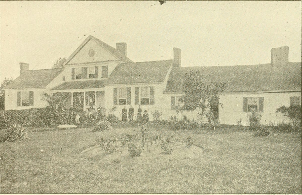
A Fairfax farmhouse, about 1904. Farms and estate houses still lined this stretch of the river when the railway's guidebook was printed.
Some Old Historic Landmarks of Virginia and Maryland (1904). Public domain, via Wikimedia Commons and the Internet Archive.
For homeowners. Houses span nearly a century. Older river lots often sit over crawlspaces, and long outdoor faucet runs are the first to freeze.
Collingwood
1930s onward
Bought by Washington1760, as part of River Farm
Named forAdmiral Cuthbert Collingwood, Nelson's second at Trafalgar
OccupantTobias Lear, Washington's private secretary, until 1816
MansionBuilt in the 1850s, demolished in 2019
Origins
Washington bought this land in 1760 as part of River Farm, and about 1785 a house was built for his overseer. Because Maryland had outlawed dueling, Marylanders rowed across the Potomac to fight here; a fatal duel helped persuade Virginia to ban the practice as well. Tobias Lear, Washington's private secretary, lived on the property until his death in 1816 and is credited with naming it for Admiral Cuthbert Collingwood.
Development
The land remained a dairy farm into the 1930s. After the railway came, part of the tract was divided into house lots. The 1850s mansion became the Collingwood on the Potomac tea room, then quarters for airline crews in World War II, an Army intelligence school in 1944, and, from 1977, the Collingwood Library and Museum on Americanism. It was demolished in 2019.
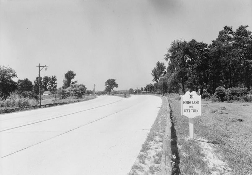
The parkway at Collingwood, 1932. A new “safety flared” intersection. The original caption described it as “streamlining” the movement of high-speed modern traffic.
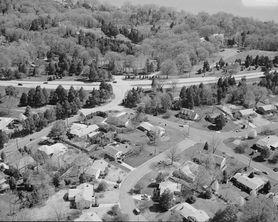
Historic American Engineering Record, HAER VA-69-213. Library of Congress, Prints & Photographs Division. Public domain.Collingwood and south Wellington from the air. The parkway crosses the top of the frame; the houses sit on large wooded lots.
Jack E. Boucher for the Historic American Engineering Record, HAER VA-69-29, 1994. Library of Congress, Prints & Photographs Division. Public domain.
For homeowners. Large wooded lots: leaves foul outdoor condenser coils and gutters, and most houses have more outdoor faucets than owners remember.
Tauxemont
1941–1955
Founded byTwenty families, most of them federal employees, as a cooperative
First purchase12.36 acres of former dairy farm for $5,680.10, March 1941
ArchitectAlexander Knowlton; co-op president Robert C. Davenport
ListedNational Register of Historic Places, 2006 — 71 contributing buildings on about 50 acres
Origins
The name recalls the Taux, or Dogue, people who lived along this part of the Potomac before English settlement.
Development
In early 1941 twenty families, most of them federal employees living in Arlington, formed Tauxemont Cooperative Houses, Inc. In March they bought 12.36 acres of dairy farm for $5,680.10. Architect Alexander Knowlton, one of the members, designed the houses and managed construction, and the families moved in that fall, having built for about seventy percent of the market price.
The typical house is a one-story cinder-block rectangle under a side-gabled roof; ten Lustron houses were added later. Without county services, residents drilled their own wells in 1941, 1942, and 1946, built a nursery school and community house, and paved their own roads. The community still runs its water system. The district was listed on the National Register of Historic Places in 2006.
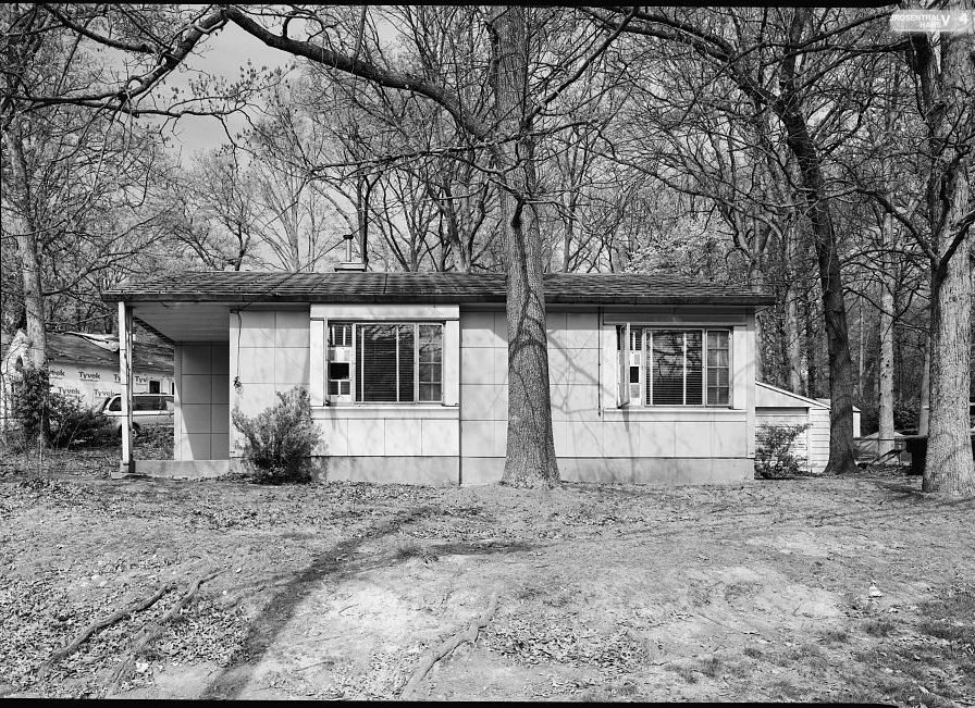
A Lustron house. The Lustron Corporation of Ohio made these factory-built houses of enameled metal panels only from 1948 to 1950. This example stands in Arlington.
James W. Rosenthal for the Historic American Buildings Survey, HABS VA-1414-1, 2006. Library of Congress, Prints & Photographs Division. Public domain.
For homeowners. Block walls sweat in humid weather, and the community well, not the county, sets the pace for water filters.
Hollin Hall Village
Platted 1943, built from 1948
DeveloperJohn McPherson Sr.
HomesRoughly 700, predominantly red brick
Named forHollin Hall, the 18th-century estate George Mason gave his son Thomson
AnniversaryCelebrated 75 years in 2018
Origins
The neighborhood is named for Hollin Hall, the plantation George Mason gave his son Thomson in 1781 and 1786. Industrialist Harley Wilson bought the estate in 1916. Mount Vernon Unitarian Church has owned it since 1958, and in 1961 it hosted a Congress of Racial Equality training workshop.
Development
Fairfax County approved the first two sections in 1943, but the war delayed construction until 1948. Developer John McPherson Sr. then built about 700 houses, most of them one-story red brick, with major expansion in the early 1950s. The two shopping centers on Fort Hunt Road were part of the original plan. The first Hollin Hall Elementary, built in the late 1940s on Shenandoah Road, now serves as a senior center and preschool.
For homeowners. Many air handlers sit in the attic above plaster ceilings, so a clogged drain line shows up as a ceiling stain. Most second-story additions brought a second system.
Hollin Hills
Land bought 1946, houses 1949–1971
DeveloperRobert C. Davenport — the same man who led the Tauxemont cooperative
ArchitectCharles M. Goodman; landscape by Lou Bernard Voigt, later Dan Kiley and Eric Paepcke
Scale326 acres, roughly 450 to 475 houses
ProtectedNational Register 2013; Fairfax County Historic Overlay District since 2022
Development
In 1946 Robert C. Davenport, who had led the Tauxemont cooperative, bought 225 acres of steep, wooded hillside that other builders had passed over. Architect Charles M. Goodman designed eight modular house types in fifteen variations, with open plans, window walls, and low-slope roofs, and placed them to follow the slopes and trees. Lots and houses were sold separately, an unusual arrangement at the time.
The first house was finished in November 1949. Davenport added 101 acres in 1956, and the sales office closed in 1971. Hollin Hills became one of the most studied modern subdivisions in the United States. It was listed on the National Register of Historic Places in 2013 and became a Fairfax County Historic Overlay District in 2022.
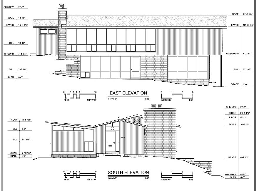
Goodman's most popular design. Unit House No. 2B42LB, 2224 Glasgow Road, built in 1953; more than two hundred houses of this type were built. The lower level is cut into the hill, so the house reads as one story from the street.
Historic American Buildings Survey, HABS VA-586-B, sheet 4 (2017). Library of Congress, Prints & Photographs Division. Public domain.
For homeowners. There is usually no conventional attic; mechanical rooms are on the lower level. Exterior changes need Architectural Review Board approval.
Stratford Landing
From 1956
BuildersErnest C. Beck and Walter Beck, a Long Island firm
SalesThe Stratford Realty Company
ScaleAbout 150 acres, advertised as an $8 million development
Original pricesIn the $20,000s, at 4 to 4.5 percent interest
Origins
The neighborhood lies along Little Hunting Creek, where the electric railway crossed on its way to Mount Vernon.
Development
Construction began in 1956 under Ernest C. and Walter Beck, builders from Long Island, with sales by the Stratford Realty Company. Advertisements promised an $8 million development on about 150 acres, four-bedroom split-levels and three-bedroom ranches in the $20,000s, and a floating sales office on the creek. The neighborhood grew past 700 houses through the 1960s and 1970s. Stratford Landing Elementary opened on September 3, 1963.
For homeowners. Split levels hide a return grille on the stair landing. Houses near the creek run damp, so the sump pump and AC drain line matter.
Waynewood
Opened 1957
DeveloperClarence W. Gosnell, Inc.
LandAbout 301 acres, assembled from five separate owners
Homes753, in roughly 18 different models
Also by GosnellWestgrove and Riverside Gardens
Development
Waynewood lies on River Farm. Clarence W. Gosnell, Inc. assembled about 301 acres from five owners and opened sales in 1957. With 753 houses in some eighteen models, it is the largest Gosnell community in the corridor.
The school came with the neighborhood: in 1957 the county renamed its planned Plymouth Haven school Waynewood Elementary, and it opened in 1959. Gosnell agreed to deed eight acres for recreation once 150 families joined; the committee hired architect Richard Gomersall to design a pool house before the deed arrived. The ball field was named for committee chairman Earl Shafer in 1968.
For homeowners. Eighteen models mean eighteen filter locations, and many houses added a second system with later additions.
Villamay
First house 1958
DeveloperGene May, a Texas engineer and builder
HomesAbout 250, most with four or five bedrooms
LotsCommonly a quarter to a half acre, many with river views
Citizens' AssociationFormed 1960, first president R. Lomax Wells, M.D.
Origins
In 1703 Thomas Sandiford received a Crown grant of 598 acres covering most of today's Villamay. The land later passed to William Dorrell and his wife, Anne Fouke Mason, a daughter of Colonel George Mason. In 1789 Roger West, son of Alexandria surveyor Colonel John West, was granted 471 adjoining acres to the north. Local tradition, not documented, holds that Washington watered his horses at West's springs.
Development
Texas engineer and builder Gene May developed Villamay in sections through the late 1950s and 1960s. The first house went up in 1958, and residents formed a citizens' association in 1960 with Dr. R. Lomax Wells as president. Its roughly 250 houses are mostly four or five bedrooms, many with river views.
For homeowners. Larger houses often have two systems and thick media filters, and bluff lots catch river dust in spring.
Riverside Gardens
1963–1966
DeveloperClarence W. Gosnell, Inc., which took the property in 1962
HonorsFirst Prize Community, Northern Virginia Builders' Association, 1964 and 1965
Origins
The land passed through the Snowden, Hunter, Ballinger, and Thompson families. Around the Civil War it belonged to William Hunter of Cedar Hill, and Jessie and Catherine Murray held it until 1892. The riverfront then had an amusement park, a bathing beach, and summer cottages.
Development
Clarence W. Gosnell, Inc., builder of Westgrove and Waynewood, acquired the property in 1962. The first house sold in March 1963 and the last was finished in 1966: 219 houses in five models, the Sweetbriar, Lexington, Haddon, Oxford, and Portsmouth. The Northern Virginia Builders' Association named it First Prize Community in 1964 and 1965.
For homeowners. In the split foyers, the air handler is on the lower level with the filter slotted into the bottom of the unit.
Mason Hill
Mainly 1960s and 1970s
StreetsMason Hill Drive, Hollinwood Drive, Rippon Road, Leith Place, Windmill Court
LocationBetween Fort Hunt Road and Range Road, immediately south of Hollin Hills
StylesColonials, ramblers, and contemporaries, with later infill into the 1980s
SchoolsHollin Meadows, Sandburg, West Potomac
Development
Mason Hill lies between Fort Hunt Road and Range Road, just south of Hollin Hills, on land associated with the Masons' Hollin Hall; no document found explains the name. Most houses were built in the 1960s and 1970s, with infill into the 1980s, on loops and courts rather than a grid. The Hollin Hills historic district boundary runs along Mason Hill Drive, so some houses on that street are Goodman designs inside the district.
Mason Hill is the least documented of the eleven neighborhoods. Its dates come from property records and county aerial photographs.
For homeowners. Built with central air from the start; two systems and thick filters are common. Houses from about 1965 to 1973 may have aluminum branch wiring, which is a job for a licensed electrician.
The corridor
Eleven neighborhoods between Fort Hunt Road and the Potomac, arranged roughly as they sit on the ground. Schematic, not to scale.
Summary
Two estates. Most of the corridor was once Washington's River Farm (east and south) or the Masons' Hollin Hall (west and north).
Transportation. The electric railway (1892–1932) and then the parkway (1932) made the corridor reachable from Washington.
Federal presence. Fort Hunt and the parkway shaped the corridor's edges, and federal workers bought many of its first houses.
Rapid building. Most houses went up between 1948 and 1966; Hollin Hills continued to 1971 and Mason Hill into the 1970s.
One developer, two neighborhoods. Robert C. Davenport led the Tauxemont cooperative in 1941 and began Hollin Hills in 1946, both designed around the land's slopes and trees.
Neighborhoods built in one campaign age in one campaign. When a neighbor replaces a system, a roof, or a water heater, the house next door is often on a similar schedule.
Limits of the record
Wellington and Mason Hill. Their subdivision histories are not well documented; dates rest on property records and county aerial photographs.
Belle Haven's name. One account traces it to Scottish settlers and the Earl of Belhaven; the claim is widely repeated but not clearly sourced.
Washington's horses in Villamay. Local tradition, presented here as such.
House counts. Figures vary by a few dozen depending on where boundaries are drawn.
Homeowner notes. These describe common patterns for each era and house type, not any particular address.
Appendix: Six House Types
Almost every house we service is a version of one of these. The marked dot shows where the air handler and its filter usually sit in that house type — not a promise about your address, but a good bet before we walk in.
The 1920s colonial
Belle Haven, and scattered through Wellington
Built before central air conditioning existed, so whatever cools these houses was added later. Ductwork was threaded through closets, chases, and the attic as best it could be, often in more than one campaign. Filters turn up in a hall closet, a basement, or a ceiling return — sometimes all three in one house.
The Tauxemont block house
1941 to 1955
A one-story cinder-block rectangle under a side gable, sited low into the ground with few steps. Ten of them are Lustrons, prefabricated in metal. Small original footprints mean most have been added to, and additions are where second systems hide. These are also the houses on the community well, so water filtration runs on its own schedule here.
The brick rambler
Hollin Hall Village, from 1948
Solid brick, one story, compact plan. The air handler is typically in a hall closet or up in the attic, reached by a pull-down ladder, with the return in a hallway or ceiling grille. This is the house type the ladder was invented for, and the reason most of our Hollin Hall customers signed up.
The Goodman house
Hollin Hills, 1949 to 1971, and parts of Mason Hill Drive
Eight unit types in fifteen variations, built from standardized modules: low-slope roof, window walls without trim, open plan, and often a level set into the slope so the street sees one story where there are two. Usually no conventional attic, which rules out the most common filter location in the corridor. The mechanical room is frequently on the lower level, and on a house that reads as single-story from the road, that level is easy to forget exists. Anything visible from outside is subject to Architectural Review Board oversight.
The split level
Stratford Landing 1956, Waynewood 1957
Four bedrooms, two and a half baths, three staggered floors. The air handler usually lives on the lowest level, and the return is very often a tall grille on the stair landing — the most frequently forgotten filter in the corridor, because nobody thinks of a stairwell as a place that needs maintenance.
The split foyer
Riverside Gardens, 1963 to 1966
You walk in and immediately go up or down. The air handler sits on the lower level, usually in a utility room off the entry, with the filter slotted into the bottom of the unit rather than behind a wall grille. Riverside Gardens was built in only five models, so once we have measured a few, we can often tell you your filter size over the phone.
Further Reading and Sources
Most of this history can be checked for free.
National Park Service: Fort Hunt Park
Park histories of the coastal fort, the Civilian Conservation Corps camp, and P.O. Box 1142, including an oral history project with its veterans.
Federal government, public domain
Library of Congress: HABS/HAER/HALS collection
Surveys of the George Washington Memorial Parkway (HAER VA-69 and VA-42), Fort Hunt (HABS VA-1370-A, HALS VA-11), and Hollin Hills (HABS VA-586), with photographs, drawings, and written histories.
Federal government, public domain
Fairfax County Historical Imagery Viewer
County aerial photographs from 1937, 1953, 1960, 1972, and later years. Search by address and compare two years side by side. The images are copyrighted by Fairfax County, so they are described here rather than reproduced.
Free to view; copyright Fairfax County
National Register nominations
Tauxemont Historic District (2006), with an address-by-address inventory, and Hollin Hills Historic District (2013). The county's Historic Overlay District map shows the Hollin Hills boundary along Mason Hill Drive.
Government documents
Fairfax County Public Library, Virginia Room
A photographic archive, deed books, plat maps, and a historical newspaper index. The 1956–1957 newspaper advertisements for these neighborhoods are available with a library card.
Free to view; rights vary by item
Civic association histories
Tauxemont, Hollin Hills, Riverside Gardens, Stratford Landing, and Villamay publish their own histories. Stratford Landing's includes a map of the railway's stations.
Published by the neighborhoods
Sources: National Park Service histories of Fort Hunt and P.O. Box 1142; Historic American Buildings Survey, Engineering Record, and Landscapes Survey records at the Library of Congress; National Archives photographs; the National Register nominations for the Tauxemont (2006) and Hollin Hills (2013) historic districts; Fairfax County planning and school records; civic association histories (Tauxemont, Hollin Hills, Riverside Gardens, Stratford Landing, Villamay); the Collingwood Library and Museum; and local reporting from ALXnow, Patch, Alexandria Times, Alexandria Living, and Virginia Living.
Fort Hunt Filters is operated by ILYSTICS LLC, Alexandria, Virginia. We change filters and handle routine seasonal maintenance; we do not perform HVAC, electrical, plumbing, or roofing repairs.
We Work on These Houses
Fort Hunt Filters changes filters and handles seasonal maintenance in all eleven neighborhoods, every three months.